| dc.contributor.author | Derrick, Michael | |
| dc.coverage.spatial | Oslo, Norge | nb_NO |
| dc.date.accessioned | 2018-10-02T07:15:41Z | |
| dc.date.available | 2018-10-02T07:15:41Z | |
| dc.date.created | 2018-10-01T16:08:43Z | |
| dc.date.issued | 2018 | |
| dc.identifier.uri | http://hdl.handle.net/11250/2565604 | |
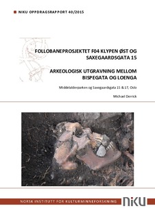
| dc.description.abstract | An archaeological evaluation and excavation was carried out along the eastern side of the railway embankment known as Klypen in Gamlebyen, in the period 22.4.2014–14.4.2015, prior to the construction of a culvert which would contain four sets of railway lines. These lines would serve the Follo Line in both directions, as well as providing the incoming line for Østfoldbanen. An additional evaluation and excavation took place in the period 21.1.2015–23.3.2015 around the property Saxegaardsgata 15 in advance of drainage work. The Klypen Øst evaluation phase comprised trenching along the length of the embankment to locate archaeological deposits. This identified two main areas of interest. The first area, labelled F–G, contained the remains of medieval houses and lay towards the northern end of Klypen Øst. It was decided to excavate these remains together with those from the Follobanen F03 project since the two project areas lay next to one another. The second area lay towards the southern end of Klypen Øst, between Clemens church (Clemenskirken) and Saxegården. This area, labelled A–D, contained thick archaeological deposits. Areas A, C and D were excavated during 2014–15 while Area B was excavated in 2016 (Hegdal forthcoming 2018). Areas A, C and D together with the drainage ditch around Saxegaardsgata 15, form the basis of this report. | nb_NO |
| dc.description.sponsorship | Jernbaneverket Utbygging Follobanen / Bane NOR SF Follobanen | nb_NO |
| dc.language.iso | eng | nb_NO |
| dc.publisher | Norsk institutt for kulturminneforskning | nb_NO |
| dc.relation.ispartofseries | NIKU Oppdragsrapport;40/2015 | |
| dc.rights | Attribution-NonCommercial-NoDerivatives 4.0 Internasjonal | * |
| dc.rights.uri | http://creativecommons.org/licenses/by-nc-nd/4.0/deed.no | * |
| dc.subject | kirkegård | nb_NO |
| dc.subject | Nikolaikirken | nb_NO |
| dc.subject | vollgrav | nb_NO |
| dc.subject | Gamlebyen | nb_NO |
| dc.subject | ovn | nb_NO |
| dc.subject | bosetningsspor | nb_NO |
| dc.subject | graver | nb_NO |
| dc.subject | skjeletter | nb_NO |
| dc.subject | steinkjeller | nb_NO |
| dc.subject | Clemenskirken | nb_NO |
| dc.subject | grophus | nb_NO |
| dc.subject | dyrking | nb_NO |
| dc.subject | bygninger | nb_NO |
| dc.subject | strete | nb_NO |
| dc.subject | bytopografi | nb_NO |
| dc.subject | C14 | nb_NO |
| dc.subject | radiokarbondatering | nb_NO |
| dc.subject | DNA | nb_NO |
| dc.subject | osteologi | nb_NO |
| dc.subject | Kongsgården | nb_NO |
| dc.subject | befestning | nb_NO |
| dc.subject | jernbane | nb_NO |
| dc.title | Follobaneprosjektet F04 Klypen Øst og Saxegaardsgata 15. Arkeologisk utgravning mellom Bispegata og Loenga. Middelalderparken og Saxegaardsgata 15 & 17, Oslo | nb_NO |
| dc.type | Research report | nb_NO |
| dc.description.version | publishedVersion | nb_NO |
| dc.rights.holder | Norsk institutt for kulturminneforskning | nb_NO |
| dc.source.pagenumber | 228 | nb_NO |
| dc.identifier.cristin | 1616889 | |
| dc.relation.project | 15621215 | nb_NO |
| dc.relation.project | 1020345 | nb_NO |
| dc.relation.project | 1020483 | nb_NO |
| cristin.unitcode | 7530,43,0,0 | |
| cristin.unitname | Arkeologiavdelingen | |
| cristin.ispublished | true | |
| cristin.fulltext | original | |

